Suburban Mobility Authority for Regional Transportation route 125 'Fort Street/Eureka Road': Difference between revisions
Jump to navigation
Jump to search


Mattb816789 (talk | contribs) mNo edit summary |
Mattb816789 (talk | contribs) No edit summary |
||
| (39 intermediate revisions by the same user not shown) | |||
| Line 4: | Line 4: | ||
|route=125 Fort Street/Eureka Road | |route=125 Fort Street/Eureka Road | ||
|muni=Romulus, Taylor, Southgate, Wyandotte, Lincoln Park, Detroit, Ecorse, River Rouge | |muni=Romulus, Taylor, Southgate, Wyandotte, Lincoln Park, Detroit, Ecorse, River Rouge | ||
|type=Main Corridor Route | |type=<font color="#4C3099">'''Main Corridor Route'''</font> | ||
|days=Daily | |days=Daily | ||
|vehicles=[[Gillig | |vehicles=[[Gillig BRT|Gillig BRT 40' (HEV)]][[Image:SmallAccessible.gif]], [[New Flyer Industries D40LF]][[Image:SmallAccessible.gif]], [[New Flyer Industries DE60LF]][[Image:SmallAccessible.gif]] | ||
|vehicleamount=7 | |vehicleamount=7 | ||
|garage=Wayne}} | |garage=[[Suburban Mobility Authority for Regional Transportation Wayne Terminal|Wayne]] | ||
|ridership=1,430}} | |||
'''125 Fort Street/Eureka Road''' is a bus route operated by the [[Suburban Mobility Authority for Regional Transportation]] in metropolitan Detroit, Michigan, United States. | '''125 Fort Street/Eureka Road''' is a bus route operated by the [[Suburban Mobility Authority for Regional Transportation]] in metropolitan Detroit, Michigan, United States. | ||
==Route Details== | ==Route Details== | ||
[[Image:Suburban Mobility Authority for Regional Transportation 3006- | [[Image:Suburban Mobility Authority for Regional Transportation 3006-b.jpg|thumb|left|[[Suburban Mobility Authority for Regional Transportation 3006-3008#3006|3006]] on route 125.]] | ||
[[Image:Suburban Mobility Authority for Regional Transportation routes 125 160 830 combined map ( | [[Image:Suburban Mobility Authority for Regional Transportation routes 125 160 830 combined map (2016)-a.jpg|thumb|right|300px|The pre-2020 routing of route 125. This map also shows the current routings of routes [[Suburban Mobility Authority for Regional Transportation route 160 'Downriver'|160]] and [[Suburban Mobility Authority for Regional Transportation route 830 'Downriver Park & Ride'|830]].]] | ||
This route | This route primarily services West Jefferson Avenue between Coolidge Highway and Outer Drive, Fort Street between Outer Drive and Eureka Road, Eureka Road between Fort Street and Middlebelt Road. This route services the [[Suburban Mobility Authority for Regional Transportation Southland Center Hub|Southland Center Hub]] and [[Detroit Metropolitan Wayne County Airport]]. During peak/rush hours on weekdays only, this route continues past Coolidge Highway to downtown Detroit. | ||
During | |||
===History=== | ===History=== | ||
*'''1976''' - | *'''1976''' - Route introduced as a [[Southeastern Michigan Transportation Authority]] route, replacing the Southland Center branch of route [[Suburban Mobility Authority for Regional Transportation route 110 'West Jefferson/Biddle'|110]]. Initially, it is operated as one of three branches of SEMTA's Fort Street route, the others being a branch to Flat Rock (numbered 120) and a branch that loops via Riverview neighborhoods (numbered [[Suburban Mobility Authority for Regional Transportation route 130 'Fort Street/Kennebec'|130]]). This branch operates from Eureka and Inkster Roads in Taylor north into downtown Detroit via Eureka Road, Southland Center and Fort Street. | ||
*'''January 17, 1989''' - Service carried on by SMART. | *'''January 17, 1989''' - Service carried on by SMART. | ||
*'''June 25, 1994''' - Service taken over by the [[Detroit Department of Transportation]] in a route-swapping deal. | *'''June 25, 1994''' - Service taken over by the [[Detroit Department of Transportation]] in a route-swapping deal. As a result, it is now operated almost exclusively by [[New Flyer Industries]] [[New Flyer Industries D40|D40]] and [[Motor Coach Industries]] [[Motor Coach Industries TC40-102N|TC40-102A]] buses, as at the time these were DDOT's only buses equipped with electronic destination signs. Window cards were used when [[General Motors Diesel Division|GMDD]] [[General Motors TC40-102N|TC40-102N]] and [[Rapid Transit Series|RTS]] buses were assigned, since they still had rollsigns instead. | ||
*'''April 1, 1995''' - DDOT gives control of this route back to SMART. | *'''April 1, 1995''' - DDOT gives control of this route back to SMART. | ||
*'''December 11, 1995''' - Midday, evening and weekend service rerouted from Fort and Outer Drive to Fort and Waterman Street via Outer Drive, West Jefferson and Waterman, replacing service on route 110, which becomes a weekday-rush-hour-only route. Weekday rush hour service, however, remains on Fort between Outer Drive and Waterman. | *'''December 11, 1995''' - Midday, evening and weekend service rerouted from Fort and Outer Drive to Fort and Waterman Street via Outer Drive, West Jefferson and Waterman, replacing service on route 110, which becomes a weekday-rush-hour-only route. Weekday rush hour service, however, remains on Fort between Outer Drive and Waterman. | ||
| Line 31: | Line 28: | ||
*'''September 4, 2007''' - All service now operates between Fort and Outer Drive and Fort and West End Street via Outer Drive, West Jefferson and West End. Not only does this continue service lost by the discontinuation of route 110, it also crosses over from West Jefferson to Fort even closer to the Detroit city limits. | *'''September 4, 2007''' - All service now operates between Fort and Outer Drive and Fort and West End Street via Outer Drive, West Jefferson and West End. Not only does this continue service lost by the discontinuation of route 110, it also crosses over from West Jefferson to Fort even closer to the Detroit city limits. | ||
*'''September 2008''' - Smith Terminal stop relocates to the North Terminal. | *'''September 2008''' - Smith Terminal stop relocates to the North Terminal. | ||
*'''December 12, 2011''' - | *'''December 12, 2011''' - Due to systemwide service cuts, outside of peak/rush hours on weekdays only, service now terminates at West Jefferson and Coolidge. | ||
*'''May 2013''' - Service rerouted between West Jefferson and Coolidge and Fort and West End via Coolidge and Fort after the West Jefferson Rouge River bridge is damaged as it lowered while a freighter was passing through and is closed as a result. | *'''May 2013''' - Service rerouted between West Jefferson and Coolidge and Fort and West End via Coolidge and Fort after the West Jefferson Rouge River bridge is damaged as it lowered while a freighter was passing through and is closed as a result. | ||
*'''Summer 2013''' - Rouge River detour rerouted via I-75 between Fort and Springwells after the Fort Street Rouge River bridge also closes-albeit due to scheduled construction. | *'''Summer 2013''' - Rouge River detour rerouted via I-75 between Fort and Springwells after the Fort Street Rouge River bridge also closes-albeit due to scheduled construction. As of December 31, 2015, the Fort Street Rouge River bridge has reopened, but the I-75 detour was still in place. | ||
*'''September 5, 2016''' - Following the reopening of the West Jefferson Rouge River bridge in August, the detour is discontinued and the original routing via Jefferson and West End is resumed. | |||
*'''February 4, 2019''' - A stop at the onramp from Goddard Road to Rogell Drive at the Sky Chef entrance is added, serving only southbound buses. Passengers at this stop intending to travel northbound are allowed to ride southbound buses for free to the North Terminal, after which they must pay the appropriate fare. | |||
*'''June 8, 2020''' - The separate branches to each of the Metro Airport terminals are consolidated into a single branch that serves both terminals via Middlebelt Road. A stop at the offramp from Rogell to Goddard is also added. This branch consolidation has been previously proposed as part of the SMART Path Plan. | |||
===Transfer Points=== | |||
*Metro Airport McNamara Terminal: Transfers available to [[Ann Arbor Area Transportation Authority]] route [[Ann Arbor Area Transportation Authority route 98 'AirRide'|98]]. | |||
*Metro Airport North Terminal: Western terminus. Transfers available to route [[Suburban Mobility Authority for Regional Transportation route 280 'Middlebelt South'|280]] and [[Ann Arbor Area Transportation Authority]] route [[Ann Arbor Area Transportation Authority route 98 'AirRide'|98]]. | |||
*Eureka Road and Telegraph Road: During weekday peak periods only, transfers available to route [[Suburban Mobility Authority for Regional Transportation route 275 'Telegraph'|275]]. | |||
*[[Suburban Mobility Authority for Regional Transportation Southland Center Hub|Southland Center Hub]]: Transfers available to routes [[Suburban Mobility Authority for Regional Transportation route 160 'Downriver'|160]] and [[Suburban Mobility Authority for Regional Transportation route 275 'Telegraph'|275]]. | |||
*Eureka Road and Trenton Road: Transfers available to route [[Suburban Mobility Authority for Regional Transportation route 160 'Downriver'|160]] and during weekday peak periods only route [[Suburban Mobility Authority for Regional Transportation route 830 'Downriver Park & Ride'|830]]. | |||
*Eureka Road and Fort Street: Transfers available to route [[Suburban Mobility Authority for Regional Transportation route 160 'Downriver'|160]]. | |||
*Fort Street and Northline Road/Ford Avenue: Transfers available to route [[Suburban Mobility Authority for Regional Transportation route 160 'Downriver'|160]]. | |||
*Fort Street and Southfield Road: Transfers available to route [[Suburban Mobility Authority for Regional Transportation route 140 'Southshore'|140]]. | |||
*Fort Street and Outer Drive: Transfers available to [[Detroit Department of Transportation]] route [[Detroit Department of Transportation route 19 'Fort'|19]]. | |||
*West Jefferson Avenue and Coolidge Highway: Transfers available to [[Detroit Department of Transportation]] route [[Detroit Department of Transportation route 41 'Schaefer'|41]]. | |||
*Fort Street West and Springwells Street: During weekday peak periods only, transfers available to [[Detroit Department of Transportation]] route [[Detroit Department of Transportation route 19 'Fort'|19]]. | |||
*Fort Street West and Livernois Avenue and Dragoon Street: During weekday peak periods only, transfers available to [[Detroit Department of Transportation]] route [[Detroit Department of Transportation route 30 'Livernois'|30]]. | |||
*Fort Street West and Junction Street (both directions) or Clark Street (southbound): During weekday peak periods only, transfers available to [[Detroit Department of Transportation]] route [[Detroit Department of Transportation route 11 'Clairmount'|11]]. | |||
*Fort Street West and Grand Boulevard West: During weekday peak periods only, transfers available to [[Detroit Department of Transportation]] route [[Detroit Department of Transportation route 27 'Joy'|27]]. | |||
*Fort Street West and Trumbull Street: During weekday peak periods only, transfers available to [[Detroit Department of Transportation]] route [[Detroit Department of Transportation route 29 'Linwood'|29]]. | |||
*[[Downtown Detroit]]: During weekday peak periods only, transfers available to all downtown [[Detroit Department of Transportation]] and SMART routes and the [[Transit Windsor]] [[Transit Windsor Tunnel Bus|Tunnel Bus]]. | |||
=== | ===Headways=== | ||
Buses | Last updated: '''September 5, 2016''' | ||
{| border="1" cellspacing="0" cellpadding="2" class=sortable | |||
! | |||
!Frequency | |||
!Buses Used | |||
!First bus | |||
!Last bus | |||
!Notes | |||
|- align="center" | |||
|'''Weekday Peak''' | |||
|24 | |||
|rowspan=3|7 | |||
|rowspan=3|4:34am | |||
|rowspan=3|11:13pm | |||
|Most trips Romulus-Detroit. | |||
|- align="center" | |||
|'''Weekday Midday''' | |||
|30 | |||
|Romulus-River Rouge | |||
|- align="center" | |||
|'''Weekday Evening''' | |||
|40 | |||
|Romulus-River Rouge | |||
|- align="center" | |||
|'''Saturday''' | |||
|40 | |||
|3 | |||
|5:30am | |||
|11:46pm | |||
|Romulus-River Rouge | |||
|- align="center" | |||
|'''Sunday''' | |||
|60-75 | |||
|2 | |||
|6:11am | |||
|8:15pm | |||
|Romulus-River Rouge | |||
|} | |||
===Destination Signs=== | ===Destination Signs=== | ||
*'''125 FORT ST ~ 125 | *'''125 FORT ST ~ 125 RIVER ROUGE''' | ||
* | *'''125 FORT ST ~ 125 TO DETROIT''' | ||
* | *'''125 FORT ST ~ 125 TO McNAMARA TERMINAL''' | ||
* | *'''125 FORT ST ~ 125 TO NORTH TERMINAL''' | ||
=== | ===Previous maps=== | ||
<gallery> | <gallery> | ||
File:Suburban Mobility Authority for Regional Transportation route 125 2002.jpg| | File:Suburban Mobility Authority for Regional Transportation route 125 2002.jpg|2002 | ||
Image:Suburban Mobility Authority for Regional Transportation routes 125 160 830 combined map.jpg| | Image:Suburban Mobility Authority for Regional Transportation routes 125 135 combined map (2007)-a.jpg|2007 | ||
Image:Suburban Mobility Authority for Regional Transportation routes 125 160 830 combined map.jpg|2011 | |||
Image:Suburban Mobility Authority for Regional Transportation routes 125 160 830 combined map (2015)-a.jpg|2015 | |||
</gallery> | </gallery> | ||
{{Suburban Mobility Authority for Regional Transportation}} | {{Suburban Mobility Authority for Regional Transportation}} | ||
{{Detroit Department of Transportation}} | {{Detroit Department of Transportation}} | ||
[[Category: | [[Category:Suburban Mobility Authority for Regional Transportation routes|125]] | ||
Revision as of 10:47, 9 June 2020
125 Fort Street/Eureka Road
| |||
| Communities Served | Romulus, Taylor, Southgate, Wyandotte, Lincoln Park, Detroit, Ecorse, River Rouge | ||
| Route Type | Main Corridor Route | ||
| Days of Operation | Daily | ||
| Vehicles Used | Gillig BRT 40' (HEV) | ||
| Vehicles at Peak | 7 | ||
| Terminal | Wayne | ||
| Average Daily Weekday Ridership (2018) | 1,430 | ||
125 Fort Street/Eureka Road is a bus route operated by the Suburban Mobility Authority for Regional Transportation in metropolitan Detroit, Michigan, United States.
Route Details
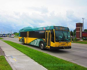
3006 on route 125.
-a.jpg)
This route primarily services West Jefferson Avenue between Coolidge Highway and Outer Drive, Fort Street between Outer Drive and Eureka Road, Eureka Road between Fort Street and Middlebelt Road. This route services the Southland Center Hub and Detroit Metropolitan Wayne County Airport. During peak/rush hours on weekdays only, this route continues past Coolidge Highway to downtown Detroit.
History
- 1976 - Route introduced as a Southeastern Michigan Transportation Authority route, replacing the Southland Center branch of route 110. Initially, it is operated as one of three branches of SEMTA's Fort Street route, the others being a branch to Flat Rock (numbered 120) and a branch that loops via Riverview neighborhoods (numbered 130). This branch operates from Eureka and Inkster Roads in Taylor north into downtown Detroit via Eureka Road, Southland Center and Fort Street.
- January 17, 1989 - Service carried on by SMART.
- June 25, 1994 - Service taken over by the Detroit Department of Transportation in a route-swapping deal. As a result, it is now operated almost exclusively by New Flyer Industries D40 and Motor Coach Industries TC40-102A buses, as at the time these were DDOT's only buses equipped with electronic destination signs. Window cards were used when GMDD TC40-102N and RTS buses were assigned, since they still had rollsigns instead.
- April 1, 1995 - DDOT gives control of this route back to SMART.
- December 11, 1995 - Midday, evening and weekend service rerouted from Fort and Outer Drive to Fort and Waterman Street via Outer Drive, West Jefferson and Waterman, replacing service on route 110, which becomes a weekday-rush-hour-only route. Weekday rush hour service, however, remains on Fort between Outer Drive and Waterman.
- May 20, 2002 - Service extended from Eureka and Inkster to Metro Airport's LC Smith Terminal via Eureka, Middlebelt, Goddard and Rogell Drive, replacing portions of the newly-discontinued route 165.
- November 27, 2006 - Service to the McNamara Terminal added, operating via Eureka and Dingell Drive. Alternating trips operate every half-hour all day to either the McNamara Terminal or the Smith Terminal. In addition, later evening service on all days is added.
- December 3, 2006 - Sunday service modified to begin earlier.
- September 4, 2007 - All service now operates between Fort and Outer Drive and Fort and West End Street via Outer Drive, West Jefferson and West End. Not only does this continue service lost by the discontinuation of route 110, it also crosses over from West Jefferson to Fort even closer to the Detroit city limits.
- September 2008 - Smith Terminal stop relocates to the North Terminal.
- December 12, 2011 - Due to systemwide service cuts, outside of peak/rush hours on weekdays only, service now terminates at West Jefferson and Coolidge.
- May 2013 - Service rerouted between West Jefferson and Coolidge and Fort and West End via Coolidge and Fort after the West Jefferson Rouge River bridge is damaged as it lowered while a freighter was passing through and is closed as a result.
- Summer 2013 - Rouge River detour rerouted via I-75 between Fort and Springwells after the Fort Street Rouge River bridge also closes-albeit due to scheduled construction. As of December 31, 2015, the Fort Street Rouge River bridge has reopened, but the I-75 detour was still in place.
- September 5, 2016 - Following the reopening of the West Jefferson Rouge River bridge in August, the detour is discontinued and the original routing via Jefferson and West End is resumed.
- February 4, 2019 - A stop at the onramp from Goddard Road to Rogell Drive at the Sky Chef entrance is added, serving only southbound buses. Passengers at this stop intending to travel northbound are allowed to ride southbound buses for free to the North Terminal, after which they must pay the appropriate fare.
- June 8, 2020 - The separate branches to each of the Metro Airport terminals are consolidated into a single branch that serves both terminals via Middlebelt Road. A stop at the offramp from Rogell to Goddard is also added. This branch consolidation has been previously proposed as part of the SMART Path Plan.
Transfer Points
- Metro Airport McNamara Terminal: Transfers available to Ann Arbor Area Transportation Authority route 98.
- Metro Airport North Terminal: Western terminus. Transfers available to route 280 and Ann Arbor Area Transportation Authority route 98.
- Eureka Road and Telegraph Road: During weekday peak periods only, transfers available to route 275.
- Southland Center Hub: Transfers available to routes 160 and 275.
- Eureka Road and Trenton Road: Transfers available to route 160 and during weekday peak periods only route 830.
- Eureka Road and Fort Street: Transfers available to route 160.
- Fort Street and Northline Road/Ford Avenue: Transfers available to route 160.
- Fort Street and Southfield Road: Transfers available to route 140.
- Fort Street and Outer Drive: Transfers available to Detroit Department of Transportation route 19.
- West Jefferson Avenue and Coolidge Highway: Transfers available to Detroit Department of Transportation route 41.
- Fort Street West and Springwells Street: During weekday peak periods only, transfers available to Detroit Department of Transportation route 19.
- Fort Street West and Livernois Avenue and Dragoon Street: During weekday peak periods only, transfers available to Detroit Department of Transportation route 30.
- Fort Street West and Junction Street (both directions) or Clark Street (southbound): During weekday peak periods only, transfers available to Detroit Department of Transportation route 11.
- Fort Street West and Grand Boulevard West: During weekday peak periods only, transfers available to Detroit Department of Transportation route 27.
- Fort Street West and Trumbull Street: During weekday peak periods only, transfers available to Detroit Department of Transportation route 29.
- Downtown Detroit: During weekday peak periods only, transfers available to all downtown Detroit Department of Transportation and SMART routes and the Transit Windsor Tunnel Bus.
Headways
Last updated: September 5, 2016
| Frequency | Buses Used | First bus | Last bus | Notes | |
|---|---|---|---|---|---|
| Weekday Peak | 24 | 7 | 4:34am | 11:13pm | Most trips Romulus-Detroit. |
| Weekday Midday | 30 | Romulus-River Rouge | |||
| Weekday Evening | 40 | Romulus-River Rouge | |||
| Saturday | 40 | 3 | 5:30am | 11:46pm | Romulus-River Rouge |
| Sunday | 60-75 | 2 | 6:11am | 8:15pm | Romulus-River Rouge |
Destination Signs
- 125 FORT ST ~ 125 RIVER ROUGE
- 125 FORT ST ~ 125 TO DETROIT
- 125 FORT ST ~ 125 TO McNAMARA TERMINAL
- 125 FORT ST ~ 125 TO NORTH TERMINAL
Previous maps

2002
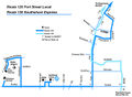
2007

2011

2015