File:MiWay route 28 Confederation map (10-2015).png
Jump to navigation
Jump to search

Size of this preview: 463 × 599 pixels. Other resolution: 768 × 994 pixels.
Original file (768 × 994 pixels, file size: 350 KB, MIME type: image/png)
Summary
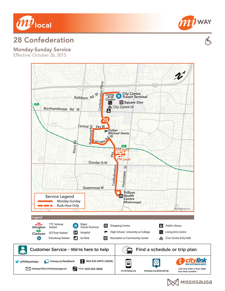
MiWay route 28 Confederation map, showing routing from October 26, 2015 to present.
File history
Click on a date/time to view the file as it appeared at that time.
| Date/Time | Thumbnail | Dimensions | User | Comment | |
|---|---|---|---|---|---|
| current | 16:42, 18 January 2021 | | 768 × 994 (350 KB) | Silly Tilley (talk | contribs) | MiWay route 28 Confederation map, showing routing from October 26, 2015 to present. |
You cannot overwrite this file.
File usage
The following page uses this file:
.png&oldid=532180)